

Wangdue
Western Bhutan
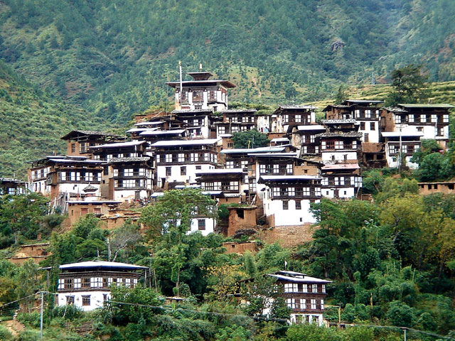
Wangdue town at 1240m lies around 20km, half hour drive from Punakha and around 10 minutes drive from Lobesa. The small town of white washed wooden shops and resturants has ramshackle but untouched air about it The new township has been planned and constructed 4km north in the valley but there is no concreate plans as when it will be moved. Almost as it is names sounds, the place around here is often very windy at times.
- Best time to visit
- March to May, September to November
- Getting there
- By road from Thimphu, about 2.5 to 3 hours, or from Punakha, about 30 minutes
- Suggested stay
- 1 to 2 nights
Places in and around Wangdue
Groups always run in this order. Inside each group, the must-see picks come first; hikes and places to stay follow the order Windhorse recommends.
Sights and attractions in Wangdue
16-
Sight
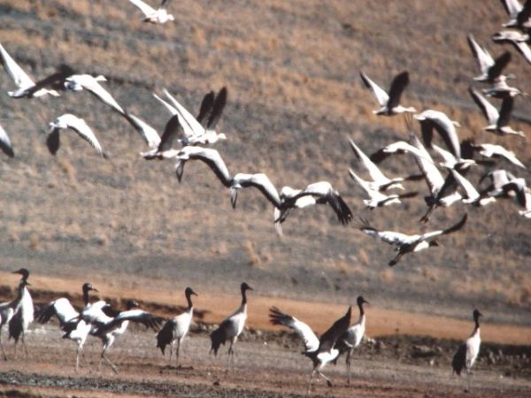
Black-necked Crane
‘Thrung Trung Karmo' as this bird is passionately known in Bhutan is the subject of many Bhutanese songs and folklore.
-
Sight
Chukarpo to Thampe Tsho
Approx. 18km, 5-6 hours trek / 400m ascent, 640m descent We continue descend along the bank of the river until we reach a yak pasture at Gala Pang Chhu (4010m).
-
Sight
Gangtey to Trongsa drive
From Gangtey, the road ascends up to Lawa La pass(3360mts) through a stretch of a rough road and rejoins the east-west highway and ascends to Pele la pass(3420mts).
-
Sight
Jichu Dramo to Chukarpo
Approx. 18km. 5-6 hrs trek / 320m ascent, 730m descent Climbs through a moraine to Rinchen Zoe La pass (5320m), which divides the Pho Chhu and Mangde Chhu drainages.
-
Sight
Maurothang to Sephu (trek Ends)-
Aprrox.18km. 5-6 hrs / 990m descent. Here our Yak drivers change and we now have to get the horses (mules).
-
Sight
Road from Gangtey to Jakar
The road journey between Gangtey and Bumthang in Bhutan is a scenic adventure through stunning landscapes.
-
Sight
Thampe Tsho to Maurothang
Approx. 14km, 5 hours / 280m ascent, 1020m descent Climb steeply to Thampe La at 4600m, where you may see blue sheep high on the slopes above the trail.
-
Temples & Monasteries
Khewang Lhakhang
Situated on the eastern side of Phobjikha Valley, opposite Tabiting, is a small monastery said to have been established in the 15th century by Trulku Penjor Gyeltshen, a…
-
Nature & Viewpoints
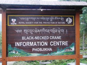
Black-Necked Crane Information Centre
This center provides insights into black-necked cranes and the valley's ecosystem. Visitors can utilize high-quality spotting scopes and cross-reference their sightings with the Field Guide to Crane Behaviour pamphlet.
-
Temples & Monasteries
Nyelung Drachaling temple
Nyelung Drachaling temple was one of the eight Ling (residences) of the 14th-century Nyingma Dzogchen master Longchen Rabjam (Longchenpa).
-
Temples & Monasteries
Gangtey Gompa Monastery
Gangteng Monastery, also known as Gangtey Sangngak Choling, was established in 1613 by the first Gangteng Tulku, Rigdzin Pema Tinley (1564–1642).
-
Nature & Viewpoints
Gangtey Nature Trail
The Gangtey Nature Trail is a tranquil two-hour trek that offers an immersive experience of Bhutan's stunning Phobjikha Valley.
-
Towns & Valleys
Gangtey – Phobjikha Valley
Phobjikha is a wide glacial valley with a central stream meandering through the open grassland and thickets of dwarf bamboo.
-
Dzongs & Fortresses
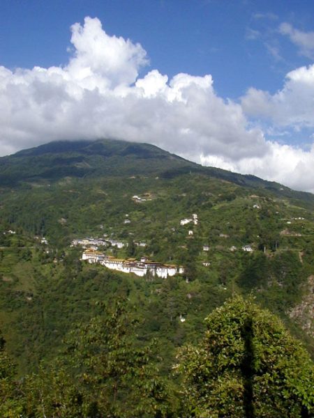
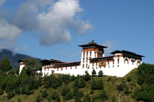
Wangdue Phodrang Dzong
Wangdue Phodrang Dzong was originally constructed in 1639 by Zhabdrung Ngawang Namgyel. It was later expanded by the Fourth Desi, Gyalsey Tenzin Rabgye, who added two more storeys to the Uste.
-
Towns & Valleys
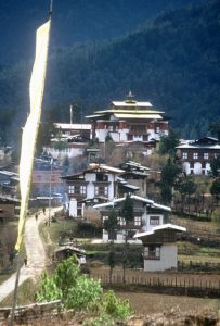
Rinchengang village
Rinchingang, recently renamed as Drinchengang, is a captivating village known for its remarkable cluster of interconnected houses. It is situated on the opposite hill, overlooking Wangdue Phodrang Dzong.
-
Temples & Monasteries
Lungchutse Temple & Retreat Center
Starting at Dochula Pass (3100m), the trail gradually ascends through a forest of hemlock, birch, and rhododendron. It's a well-marked path winding through ancient forests with towering trees.
Nothing matches these filters in Wangdue yet. Choose another type or a lower star rating.
Trips that visit Wangdue
- Bhutan Village TourDay 2: Paro –Punakha/Wangdue 9 days
- Snow Leopard Jomolhari TrekDay 2 & 3: Punakha & Wangdue Valley 14 days
- Bhutan Festival & Sikkim TourDay 09-10: In Punakha /Wangdue valley 17 days
- Drukyul Walking Tour BhutanDay 8-9: In Punakha & Wangdue 13 days
- Three Himalayan KingdomsDay 10: Drive to Punakha 15 days
- Bhutan Dragon Festival TourDay 7 & 8: In Punakha & Wangdue 12 days
- Window to BhutanDay 3: Thimphu – Punakha/Wangdue 7 days
- Introduction of India, Bhutan & NepalDay 12: Drive to Punakha 19 days